
Tropical Cyclone Rae: Rapid Intensification Near Fiji
Formation and Development
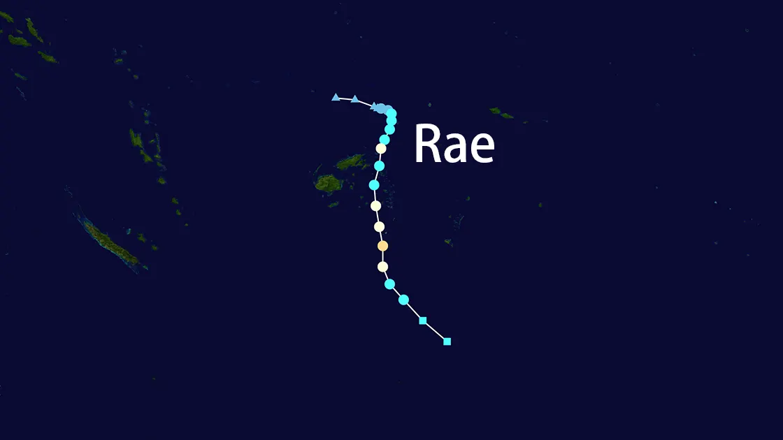
Tropical Cyclone Rae formed as a tropical depression (TD09F) on February 22, 2025, near the Fiji region. Rae's initial development showed promising signs of intensification, with the Fiji Meteorological Service closely monitoring its progression. By February 23, Rae had strengthened significantly, prompting the issuance of multiple warnings. The cyclone continued to impact the region until it completely dissipated by February 26, 2025.
Intensity Timeline
Cyclone Rae's rapid intensification was marked by several key developments:
- February 22, 12:00 UTC: Formation as tropical depression
- February 23, 06:00 UTC: Named as Tropical Cyclone Rae
- February 23, 12:00 UTC: Intensified to Category 2
- February 24, 00:00 UTC: Continued strengthening
- February 24, 18:00 UTC: Reached Category 2 with wind speeds of 105 mph
- February 25, 06:00 UTC: Wind speeds decreased to 70 mph
- February 25, 18:00 UTC: Dissipated with wind speeds of 40 mph
Impact Areas
Fiji
Cyclone Rae's approach triggered multiple responses across Fiji:
- Lau Group: Complete school closures
- Lomaiviti: Emergency preparations activated
- Vanua Levu: Eastern regions under gale warning
- Moala Group: Hurricane warning issued
Maritime Impact
Rae's presence in Fijian waters led to:
- Fiji Link domestic flight disruptions
- Maritime warnings across affected regions
- Vessel movement restrictions
Tonga's Response
As Rae approached, Tonga implemented precautionary measures:
- Tropical cyclone warning for Niuafo'ou and Niuatoputapu
- Cyclone alert for Vava'u and Ha'apai
- Heavy rain warning for all Tongan territories
- Flash flood advisories issued nationwide
Meteorological Characteristics
Cyclone Rae exhibited notable features:
- Wind Speeds: Sustained winds reaching 110 km/h
- Movement: South-southwest trajectory
- Location: East of Cikobia, tracking toward Lau Group
- Intensity: Category 2 with potential for further intensification
Emergency Response
Authorities implemented comprehensive emergency measures:
- Education Minister Aseri Radrodro ordered school closures
- Emergency services placed on high alert
- Regular meteorological updates every 3 hours
- Coordination between Fiji and Tonga's weather services
Regional Context
Cyclone Rae's development coincided with other tropical systems:
- Concurrent monitoring of Cyclone Alfred in the Coral Sea
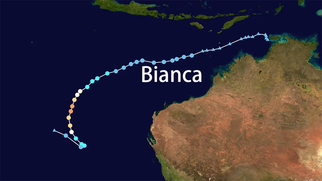
- Cyclone Bianca's presence off Western Australia
- Enhanced regional meteorological cooperation
Forecast and Warnings
The Fiji Meteorological Service projected:
- Further intensification to severe tropical cyclone status
- Continued southward movement
- Potential impacts on outer islands
- Extended period of adverse weather conditions
Recent Developments
As of February 25, 2025, Tropical Cyclone Rae has dissipated, with the last report indicating its location at 25.7° S, 176.6° W and wind speeds of 40 mph. The storm was moving southeast at 16 mph.
Unusual Cyclone Activity
Notably, three tropical cyclones—Rae, Seru, and Alfred—were active simultaneously in the South Pacific, an occurrence deemed unusual by meteorologists. This peak cyclone season, which runs from November to April, has seen significant activity, with the last similar event occurring in January 2021.
Conclusion
Tropical Cyclone Rae represents a significant weather event for the South Pacific region, demonstrating the importance of early warning systems and regional cooperation in cyclone preparedness. As Rae continues to develop, authorities maintain vigilant monitoring and response measures to protect affected communities.