
Cyclone Taliah 2025: A Comprehensive Overview
Introduction
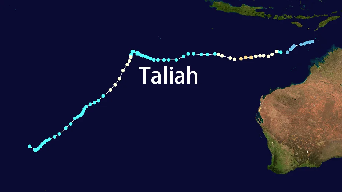
Cyclone Taliah, designated as Tropical Cyclone 14S, was a significant weather event in the South Indian Ocean during February 2025. This article provides a detailed analysis of Cyclone Taliah's development, trajectory, and eventual dissipation, based on the latest meteorological data and forecasts.
Development and Characteristics
Cyclone Taliah originated as a subtropical cyclone, exhibiting characteristics of both tropical and extratropical cyclones. The system was first identified on 18th February 2025, located approximately 1181 NM south-southeast of Port Louis, Mauritius. The cyclone's initial intensity was assessed at 40 knots, with gusts reaching up to 50 knots.
Environmental Conditions
The environmental conditions surrounding Cyclone Taliah were marginally unfavorable. Key factors included:
- Sea Surface Temperatures (SST): Cool, ranging between 23-24°C.
- Vertical Wind Shear (VWS): Moderate to high, between 20-25 knots.
- Dry Air Intrusion: Significant mid-level dry air was observed, particularly over the western semicircle of the system.
Despite these challenges, Cyclone Taliah maintained its structure due to a sustained, strong polar outflow.
Trajectory and Movement
Cyclone Taliah's movement was influenced by the southwestern periphery of a deep-layer subtropical ridge (STR) centered to the east-northeast. Over the initial 12 hours, the system tracked southwestward at 01 knot. However, as the STR weakened, Cyclone Taliah began to slow down and became quasi-stationary.
Forecasted Path
- 12 Hours: By 190600Z, Cyclone Taliah was expected to be near 31.1S 75.3E, maintaining 40 knots sustained winds.
- 24 Hours: By 191800Z, the system was forecasted to shift to 30.7S 73.8E, with winds decreasing to 35 knots.
The cyclone was predicted to turn west-southwestward as a fast-moving mid-level ridge passed to the south, leading to its eventual dissipation by TAU 48.
Dissipation
Cyclone Taliah's dissipation was attributed to increasingly hostile environmental conditions, including cooler SSTs, higher VWS, and persistent dry air intrusion. The final warning for Cyclone Taliah was issued on 18th February 2025, marking the end of its lifecycle as a tropical cyclone.
Conclusion
Cyclone Taliah 2025 was a notable meteorological event that demonstrated the complex interplay of environmental factors influencing tropical cyclones. Despite its relatively short lifespan, Cyclone Taliah provided valuable insights into the behavior of subtropical cyclones in the South Indian Ocean.
References
- Joint Typhoon Warning Center (JTWC)
- Satellite Imagery and Scatterometer Data
- Meteorological Analysis and Forecast Models