
2025 Tropical Storm Keli: A Fleeting Whisper Over the Deep Pacific
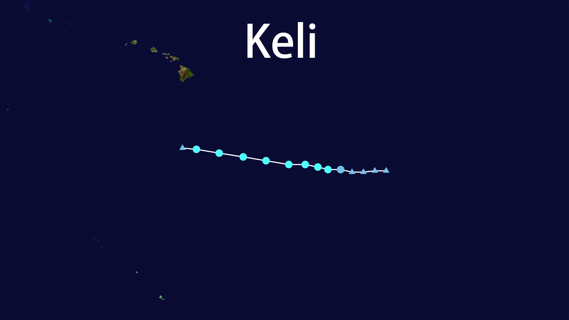
In the vast, empty expanse of the Eastern Pacific, far from any watching eyes, a subtle disturbance began to stir. On July 28, 2025, at precisely 5:00 AM HST (15:00 UTC), the ocean's energy coalesced into Tropical Depression Two-C. The coordinates 12.0°N, 143.6°W placed this nascent system a staggering 1,140 miles southeast of Honolulu – a world away from human shores. This marked the quiet beginning of Tropical Storm Keli.
The infant Tropical Storm Keli faced an immediate challenge: the sheer isolation of its birthplace and the constraints of its environment. With a persistent westward drift of 13-17 mph (20-28 km/h), it moved steadily away from Hawaii, deeper into the open ocean. By July 29th, fueled briefly by the warm waters beneath it, Tropical Storm Keli reached its modest peak. Its maximum sustained winds climbed to 40 mph (65 km/h), while its central pressure settled at 1006 millibars (29.71 inches). Even at its strongest, Tropical Storm Keli remained a relatively weak and compact system. Its position, 890 miles southeast of Honolulu, emphasized its profound isolation. There was no fanfare, no coastal warnings issued; Tropical Storm Keli's entire existence unfolded over the trackless sea.
The forces that briefly nurtured Tropical Storm Keli soon turned against it. Increasing wind shear, cooler waters encountered along its westward path, and the dry, stable air of the subtropical Pacific began to dismantle its fragile structure. The struggle was swift. By July 30th, the winds that had briefly defined Tropical Storm Keli faltered. The system weakened back to a depression, its circulation unraveling under the relentless environmental pressure. Finally, at 5:00 PM HST (21:00 UTC) on July 30, 2025, near 13.9°N, 156.6°W (roughly 520 miles south of Honolulu), Tropical Storm Keli dissipated completely. Its life cycle, a mere three days, ended as quietly as it began.
Tropical Storm Keli lived and died as the quintessential "fish storm." Its entire path, tracked meticulously by satellite but unwitnessed by any human on land or sea, remained confined to the deep Pacific waters southeast and south of Hawaii. No island felt its winds, no coastline experienced its rains. Hypothetically, its presence might have caused minor swells or posed a fleeting, distant concern for deep-sea shipping lanes, but no specific impacts were reported or verified. There were no casualties, no damage, and no disruption attributable to Tropical Storm Keli. Its legacy is one of meteorological brevity and profound insignificance to human activity.
Tropical Storm Keli serves as a reminder of the countless transient weather systems that form, peak, and fade over Earth's vast oceans. Its story, brief and contained entirely within the blue wilderness of the Pacific, is written only in satellite data points and the coordinates logged by the National Hurricane Center. By July 31, 2025, the waters where Tropical Storm Keli had briefly churned were calm once more, leaving no trace of its ephemeral passage across the face of the deep.