
Tropical Cyclone Blossom: A Brief Encounter in the 2025 South-West Indian Ocean
Tropical Cyclone Blossom (designated 03S) emerged as the third named system of the 2025-26 South-West Indian Ocean cyclone season, marking an unusual early-season formation in September 2025. This system, officially named by the Mauritius Meteorological Services, represented a fascinating meteorological case study of rapid development and equally rapid dissipation in the challenging atmospheric environment of the South Indian Ocean.
Formation and Early Development
The origins of Tropical Cyclone Blossom can be traced to September 7, 2025, when Météo-France La Réunion (MFR) began monitoring a disturbance in the South Indian Ocean. Two days later, on September 9, MFR upgraded the system to tropical depression status, marking the official formation of what would become Tropical Cyclone Blossom. The system continued to organize, and by September 11, it had intensified sufficiently to be classified as a moderate tropical storm and officially named "Blossom" by the Mauritius Meteorological Services.
Tropical Cyclone Blossom's formation timing was particularly noteworthy, occurring well outside the conventional cyclone season boundaries (November 15 to April 30) for the South-West Indian Ocean basin. This early-season activity placed Tropical Cyclone Blossom as the third system of the season, following Tropical Depression "01" (formed July 16) and Moderate Tropical Storm "Awo" (formed August 7). Such early-season formations provide valuable insights into the basin's climatic patterns and potential seasonal variations.
Intensity Evolution and Track Analysis
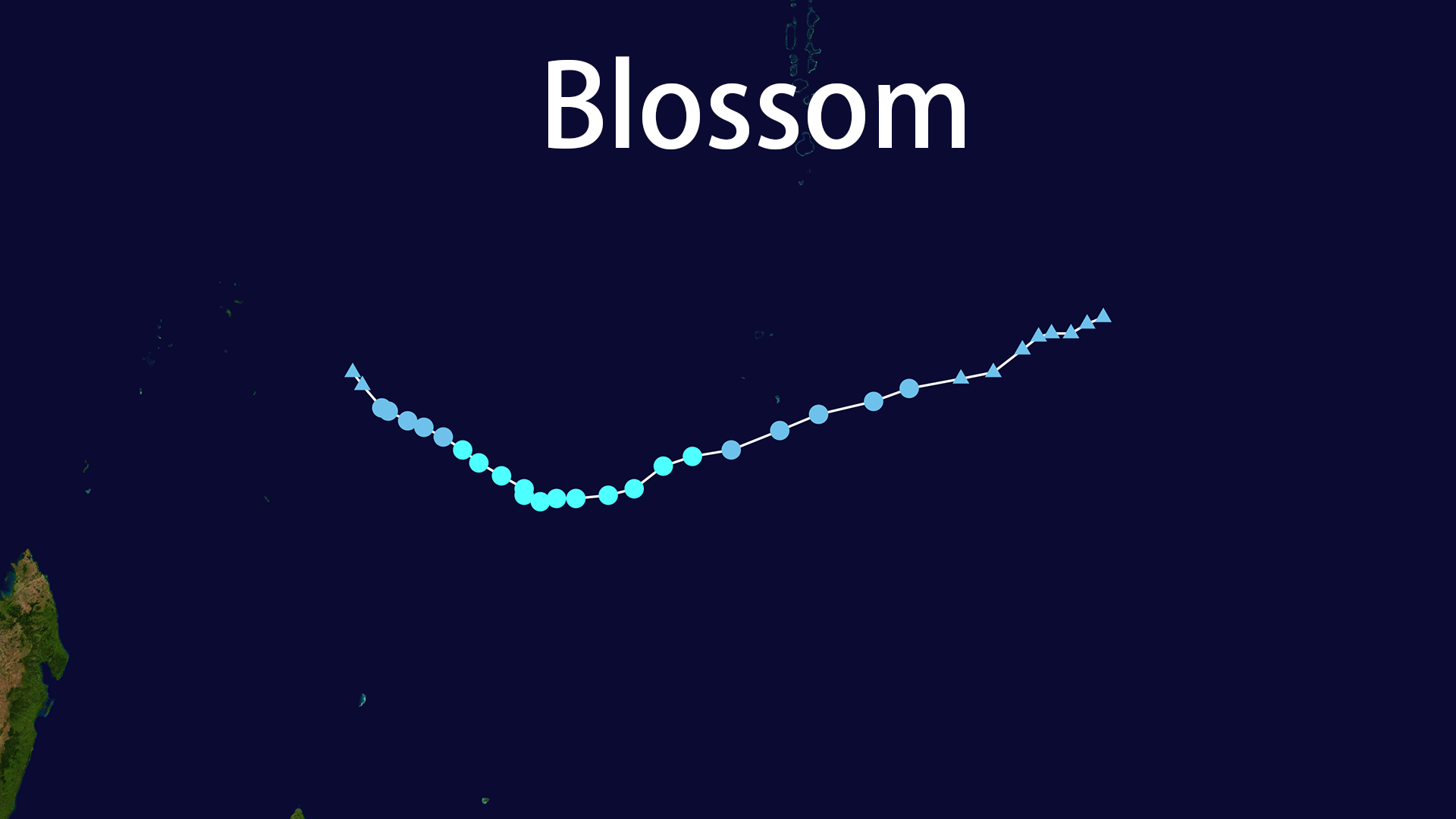
During its brief lifecycle from September 9-12, 2025, Tropical Cyclone Blossom achieved its peak intensity as a moderate tropical storm. According to MFR data, the system reached maximum sustained winds of 65 km/h (40 mph) with a minimum central pressure of 1001 hPa. The Joint Typhoon Warning Center (JTWC) classified Tropical Cyclone Blossom as a tropical storm with maximum sustained winds of 35 knots.
The track of Tropical Cyclone Blossom was meticulously documented through its westward progression across the South Indian Ocean:
- September 9, 06:00 UTC: 69.3°E, -9.1°S (Initial formation)
- September 9, 12:00 UTC: 68.4°E, -9.7°S
- September 9, 18:00 UTC: 67.2°E, -10.3°S
- September 10, 06:00 UTC: 65.4°E, -10.5°S (Peak intensity)
- September 11, 06:00 UTC: 63.8°E, -9.8°S
- September 11, 18:00 UTC: 62.8°E, -9.0°S
- September 12, 06:00 UTC: 61.5°E, -8.2°S (Final position before dissipation)
Meteorological Analysis of Rapid Dissipation
Tropical Cyclone Blossom's lifecycle was remarkably short, lasting approximately three days from formation to dissipation. The system's rapid demise was officially confirmed on September 11, when MFR downgraded Tropical Cyclone Blossom to tropical depression status and issued their final advisory. The JTWC also issued their final warning for the system.
The primary meteorological factors contributing to Tropical Cyclone Blossom's rapid dissipation were high vertical wind shear and extensive dry air intrusion. Wind shear values of 35-40 knots created an environment where the upper-level circulation was displaced from the low-level center, effectively decapitating the storm's vertical structure. Simultaneously, dry air entrainment into Tropical Cyclone Blossom's circulation core inhibited deep convection, which is essential for maintaining tropical cyclone intensity.
These adverse conditions resulted in the exposure of Tropical Cyclone Blossom's low-level circulation center and the shearing of deep convection to the system's southern quadrant. This process provides an excellent example of how atmospheric environment can determine a tropical cyclone's fate, regardless of favorable sea surface temperatures.
Impact Assessment and Warning Systems
Despite Tropical Cyclone Blossom's limited intensity, coastal communities received formal meteorological warnings. The Mauritius Meteorological Services issued special bulletins for the Agalega Islands, forecasting moderate to heavy rainfall, thunderstorms, wind gusts up to 80 km/h, and significant wave heights up to 3.5 meters, with warnings of very rough sea conditions.
Tropical Cyclone Blossom's impact on land and population was assessed as extremely low. According to the Global Disaster Alert and Coordination System (GDACS), the system caused no reported casualties and no population exposure to Category 1 or higher intensity winds. Tropical Cyclone Blossom remained over open ocean throughout its lifecycle, with no direct land impacts beyond the generation of significant wave heights up to 4 meters.
Seasonal Context and Global Significance
Tropical Cyclone Blossom represented the third system of the 2025-26 South-West Indian Ocean cyclone season, following the early-season formations of Tropical Depression "01" and Moderate Tropical Storm "Awo". All three systems formed before the conventional season start date, highlighting significant early-season activity in the basin.
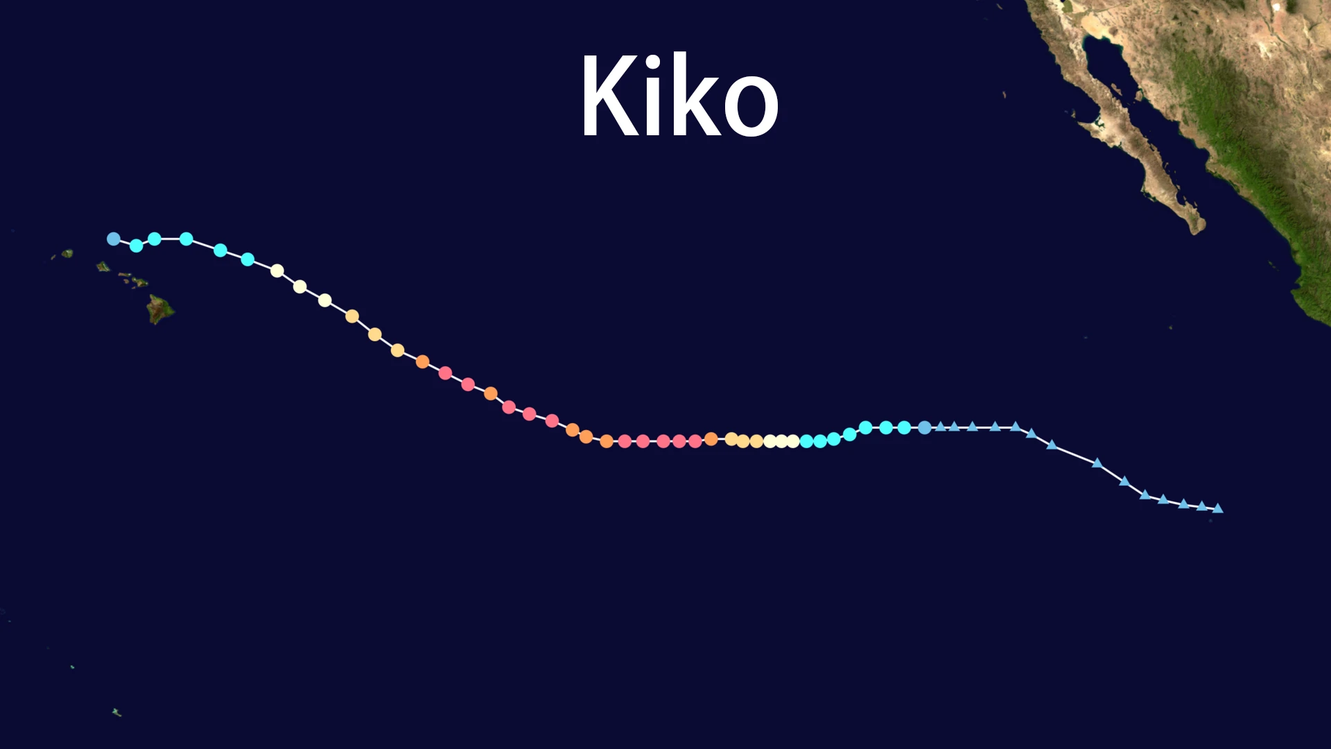
In the broader context of global tropical cyclone activity in 2025, Tropical Cyclone Blossom's brief existence and relatively low intensity positioned it as a minor event. The 2025 global cyclone season produced 94 systems, with 60 receiving names. Among these, Hurricane Erin in the North Atlantic achieved the lowest central pressure of 915 hPa, while systems like Hurricane Kiko in the Pacific rapidly intensified to Category 4 strength.
Scientific Value and Forecasting Success
Tropical Cyclone Blossom provided valuable scientific insights despite its short lifespan. The system's rapid dissipation validated modern meteorological forecasting capabilities, particularly in predicting intensity changes for systems in hostile atmospheric environments. Tropical Cyclone Blossom's formation outside conventional season boundaries and subsequent rapid weakening due to high wind shear and dry air intrusion offers a textbook example of environmental controls on tropical cyclone development.
The accurate forecasting of Tropical Cyclone Blossom's complete lifecycle—from formation through dissipation—demonstrated significant advances in meteorological science, particularly in short-term forecasting for systems facing adverse conditions. This success story underscores the importance of understanding atmospheric environment in tropical cyclone prediction.
Conclusion: Lessons from a Fleeting Storm
Tropical Cyclone Blossom may not have achieved the destructive potential of major hurricanes, but its story carries important lessons for meteorologists and the public alike. The system exemplifies how atmospheric environment can override favorable oceanic conditions, demonstrating that not all tropical disturbances develop into significant storms.
For the meteorological community, Tropical Cyclone Blossom represents a successful validation of predictive models and forecasting techniques. For the broader public, it serves as a reminder of the complex, often fragile nature of tropical weather systems and the importance of understanding environmental factors that control their development.
The brief existence of Tropical Cyclone Blossom across the remote waters of the South Indian Ocean remains a significant case study in the comprehensive record of the 2025 tropical cyclone season, providing valuable insights into early-season activity patterns and environmental controls on tropical cyclone development in the South-West Indian Ocean basin.