
Mitag: The Tropical Storm That Tested Preparedness in Southeast Asia (2025)
In the bustling heart of the 2025 Pacific typhoon season, a system that would become known as Mitag began its journey. Emerging from a low-pressure area northeast of the Philippines in mid-September, this storm, while never achieving the fearsome status of a super typhoon, became a significant test of regional disaster preparedness and highlighted the often-underestimated dangers of tropical rainfall. The story of Mitag is not one of record-breaking winds, but of resilient communities, proactive governments, and the relentless power of water.
The Meteorological Life Story of Mitag
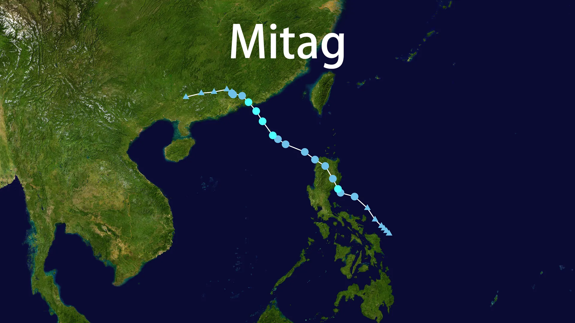
The genesis of Mitag was first noted by Philippine meteorologists on September 16, 2025. The Philippine Atmospheric, Geophysical and Astronomical Services Administration (PAGASA) promptly classified it as a tropical depression and assigned it the local name "Mirasol." Almost simultaneously, the Joint Typhoon Warning Center (JTWC) issued a Tropical Cyclone Formation Alert, noting the favorable conditions of warm seas and low wind shear that could allow the system to strengthen.
Within hours, the Japan Meteorological Agency (JMA) bestowed upon it the international name Mitag, a name of Yapese origin meaning "woman." Thus began the dual-identity life of this storm, tracked as Mitag internationally while remaining "Mirasol" for Filipinos in its path. The young storm took a northwestward track, steered by a subtropical ridge, and began to organize, developing deep convective banding around its core.
Its first encounter with land came on the evening of September 17, as it made landfall in Casiguran, Aurora province, in the Philippines. Crossing the Luzon landmass temporarily disrupted its circulation, weakening its structure. However, like many storms that enter the warm waters of the South China Sea, Mitag found renewed energy. It re-organized and briefly intensified, with the JTWC estimating its peak 1-minute sustained winds at 85 km/h (50 mph).
The storm’s final act played out on the afternoon of September 19, when it made its second and final landfall near Shanwei City in China’s Guangdong province. Once over land, the familiar story of rapid dissipation began. Friction with the terrain quickly sapped its strength, and by the next day, Mitag was downgraded to a remnant low, its moisture bringing lingering rains to southern China before it faded entirely.
A Trail of Water: Impacts Across the Philippines and China
The true legacy of Mitag was written not by wind, but by water. Its moderate strength belied a capacity to unleash torrential rainfall, triggering floods and landslides that tested the resilience of the regions in its path.
In the Philippines, the storm's initial impact was felt most acutely in the Cagayan Valley and parts of Luzon. While power outages occurred in Casiguran, the primary damage came from rising waters. Reports indicated that over 92,000 people were affected, with approximately 8,200 displaced from their homes. Tragically, the storm was linked to three indirect fatalities and five missing persons, all victims of the devastating floods it generated. Infrastructure suffered significantly, with four roads and twelve bridges rendered impassable, isolating communities and complicating relief efforts.
Across the South China Sea, Mitag delivered a similar watery punch to Guangdong province. Eastern regions, including the cities of Shantou and Chaozhou, were drenched with astonishing rainfall totals exceeding 450 mm in a 48-hour period. This led to widespread urban flooding, disrupting daily life on a large scale. While the Chinese meteorological services had accurately forecast the heavy rain and issued timely warnings, the volume of water overwhelmed drainage systems in many areas. Schools were shuttered, and flights at major hubs like Hong Kong International Airport were delayed or canceled, illustrating how even a moderate storm like Mitag can ripple through a modern economy.
The Success Story: Proactive Warnings and Mitigation
Perhaps the most compelling chapter in the Mitag story is the demonstrated effectiveness of modern early warning systems and proactive governance. Days before the storm's arrival, a coordinated effort was underway.
In the Philippines, PAGASA raised Tropical Cyclone Wind Signals for over a dozen areas, and the national disaster agency pre-positioned millions of food packs and non-food items, ready to respond. Their efforts likely prevented a higher casualty count. In China, the provincial government of Guangdong activated a Level-IV emergency response, one of the lowest levels but a crucial procedural step that triggers specific protocols. Authorities ordered fishing boats to return to port and evacuated workers from offshore installations, moving vulnerable populations away from the storm's threat.
Hong Kong and Macao, though spared a direct hit, exemplify the "better safe than sorry" doctrine. The Hong Kong Observatory (HKO) hoisted the No. 3 Strong Wind Signal, leading to the suspension of classes for kindergartens and special schools. This decision was made based on the potential for dangerous conditions, not necessarily their certainty. While some might question such caution after the fact, it represents a sophisticated risk-management strategy that prioritizes human life above all else. The successful navigation of Mitag's threats by these agencies shows a hard-earned wisdom born from past experiences with far deadlier systems.
Mitag in Context: A Lesson in Relative Risk
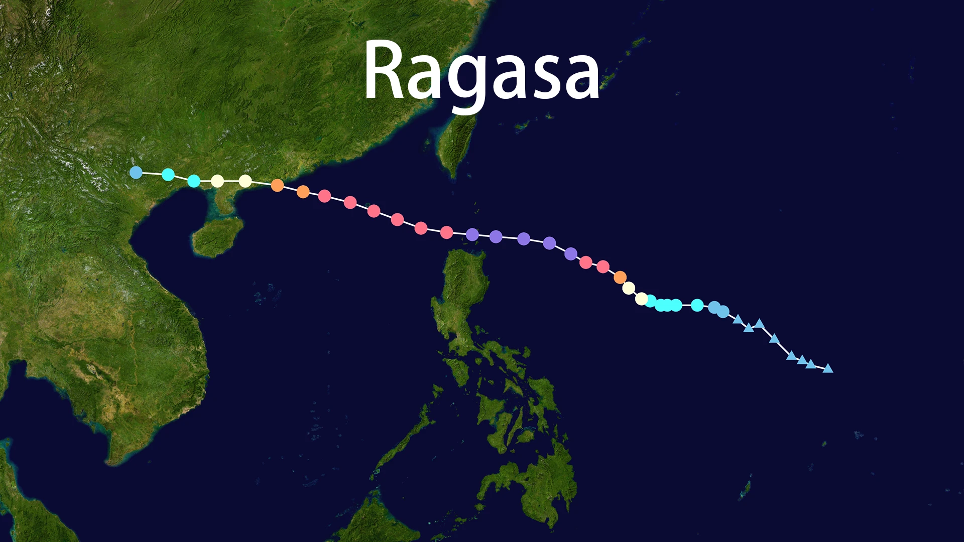
To understand Mitag fully, one must look beyond it. The 2025 season was active, with other systems like Typhoon Ragasa and Tropical Storm Neoguri swirling in the Pacific simultaneously. This phenomenon, known as the Fujiwhara effect, can make predicting a storm's path complex, though Mitag largely stayed on its predicted course.
A more telling comparison is with a historical giant: 2018's Super Typhoon Mangkhut. The contrast is stark. Mangkhut was a beast of a storm with winds of 250 km/h, causing widespread catastrophic damage and hundreds of casualties. Mitag, with a fraction of that intensity, still posed a serious threat through flooding. This juxtaposition is crucial for public awareness—it underscores that a storm does not need to be a record-breaking "super" typhoon to be dangerous. The relentless rainfall of a moderate system like Mitag can be just as deadly, emphasizing that preparedness for wind and for water must go hand-in-hand.
Conclusion: The Lasting Imprint of a Moderate Storm
Mitag may not dominate the history books like some of its more violent counterparts, but its passage in September 2025 left a meaningful imprint. It served as a live-fire drill for regional disaster management agencies, validating years of investment in forecasting, public warning systems, and emergency coordination.
The storm reinforced a critical lesson for the public and officials alike: the category of a storm tells only part of the story. The name Mitag will be remembered not for its power, but for the widespread flooding it caused and the successful efforts to mitigate its impact. In an era of changing climate patterns, the ability to respond effectively to storms of all intensities—from the monstrous to the moderate like Mitag—is perhaps our greatest defense against the unpredictable forces of nature.